Easy bike paths and long-distance cycle routes from the Reschen Pass to Bolzano
South Tyrol's inter-municipal cycle network covers more than 500 kilometres. Many bike paths follow the rivers and run through apple orchards, flat or gently downhill. Here you will find the bike paths between the Reschen Pass, Merano and Bolzano with all key facts compared, plus tips on which one suits you.
Bike paths in South Tyrol compared
Reschen Pass to Merano
- Length
- approx. 82 km
- Duration
- 4 to 5 hrs
- Elevation
- approx. 1,200 m, mostly downhill
- Surface
- mostly asphalt, three short gravel sections
Merano to Bolzano
- Length
- approx. 30 km
- Duration
- 1.5 to 3 hrs
- Elevation
- approx. 75 m
- Surface
- asphalt, suitable for road bikes
Merano to St. Leonhard
- Length
- approx. 20 km
- Duration
- 1 to 2 hrs
- Elevation
- approx. 370 m, gently uphill
- Surface
- partly gravel, partly asphalt
Landeck via Reschen Pass, Merano and Bolzano to Verona
- Length
- approx. 345 km
- Duration
- several days
- Elevation
- mostly downhill from the Reschen Pass
- Surface
- mostly asphalt, partly gravel
Donauwörth via Reschen Pass to Verona or Venice
- Length
- 690 to 750 km
- Duration
- 7 to 14 days
- Elevation
- Fern Pass and Reschen Pass
- Surface
- asphalt and gravel
| Bike path | Route | Length | Elevation | Duration | Difficulty | Surface |
|---|---|---|---|---|---|---|
| Vinschgau Bike Path | Reschen Pass to Merano | approx. 82 km | approx. 1,200 m, mostly downhill | 4 to 5 hrs | moderate | mostly asphalt, three short gravel sections |
| Merano-Bolzano Bike Path | Merano to Bolzano | approx. 30 km | approx. 75 m | 1.5 to 3 hrs | easy | asphalt, suitable for road bikes |
| Passeier Valley Bike Path | Merano to St. Leonhard | approx. 20 km | approx. 370 m, gently uphill | 1 to 2 hrs | easy | partly gravel, partly asphalt |
| Adige Cycle Path | Landeck via Reschen Pass, Merano and Bolzano to Verona | approx. 345 km | mostly downhill from the Reschen Pass | several days | long-distance route | mostly asphalt, partly gravel |
| Via Claudia Augusta | Donauwörth via Reschen Pass to Verona or Venice | 690 to 750 km | Fern Pass and Reschen Pass | 7 to 14 days | long-distance route | asphalt and gravel |
Which bike path suits you?
- With children
- The Merano-Bolzano Bike Path is almost flat, the Passeier Valley Bike Path climbs gently and has rest areas right by the river. More tips in our guide Cycling with children in Merano Country.
- On a road bike
- The Merano-Bolzano Bike Path is fully paved. On the Vinschgau Bike Path there are short gravel sections between Mals and Schlanders. For mountain passes and longer rides: road bike tours in Merano Country and Vinschgau.
- A day trip with great scenery
- The Vinschgau Bike Path from Mals or the Reschen Pass to Merano: Lake Reschen, Glurns, Laas and numerous castles, mostly gently downhill.
- A multi-day cycling trip
- The Adige Cycle Path leads to Verona, the Via Claudia Augusta starts as far away as the Danube. In South Tyrol both follow the same route.
- Loop tours away from the valley paths
- If you prefer a loop to a point-to-point ride, you will find easy bike tours and e-bike tours with stops at mountain huts and wine taverns.
Adige Cycle Path
The Adige Cycle Path (German: Etschradweg) is a long-distance route from Landeck in Tyrol via the Reschen Pass to Merano, Bolzano, Trento and Verona, around 345 kilometres in total. From the Reschen Pass to Verona it is still about 280 kilometres. The route mostly follows the banks of the Adige (German: Etsch) and runs mostly gently downhill from the Reschen Pass.
Two sections in South Tyrol are also popular as day trips: the Vinschgau Bike Path from the Reschen Pass to Merano and the Merano-Bolzano Bike Path.

Via Claudia Augusta Cycle Path
The Via Claudia Augusta follows a Roman trade road from Donauwörth on the Danube via Augsburg, Füssen, the Fern Pass and the Reschen Pass to Italy. From Trento the route splits: the Padana variant leads via Verona to Ostiglia (around 690 km), the Altinate variant via Feltre to Altino near Venice (around 750 km).
Most cyclists plan 7 to 14 days for the entire route. Through South Tyrol, the Via Claudia Augusta follows the same route as the Adige Cycle Path.
Vinschgau Valley Cycle Route
The Vinschgau Bike Path (Val Venosta) runs around 82 kilometres from the Reschen Pass to Merano, descending about 1,200 metres, mostly gently downhill. Along the way you pass Lake Reschen with its submerged church tower, the medieval town of Glurns, the marble village of Laas and numerous castles.
Most of it is paved; between Mals and Schlanders there are three short gravel sections. Current rules for taking bikes on the Vinschgau train can be found on the detail page.
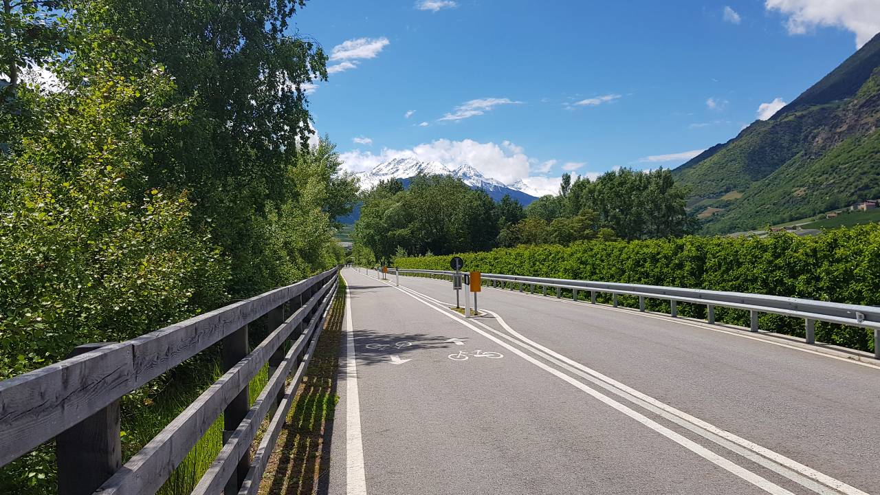
Bike Path Merano-Bolzano
The Merano-Bolzano Bike Path is around 30 kilometres long, fully paved and almost flat. It mostly runs along the Adige and the railway line through the orchards of the Adige Valley.
The bike path is suitable for families as well as road cyclists and is easy to ride from February to November.

Passeier Valley Bike Path
The Passeier Valley Bike Path runs for around 20 kilometres from Merano to St. Leonhard in Passeier. It follows the Passer river and climbs gently by about 370 metres.
The path is largely natural, partly gravel, partly asphalt. Rest areas by the river and the villages along the way make it a popular bike path for families and leisure cyclists.

South Tyrol cycling map: the cycle network in five stages
The South Tyrolean cycle network connects seven towns in five stages. The South Tyrol cycling map shows all stages at a glance. For the bike paths in Merano Country and Vinschgau, the detail pages offer an interactive map and GPX files.
- Sterzing (Vipiteno) to Bruneck (Brunico): From the old Fugger town of Sterzing along the Eisack and Rienz rivers, past the Franzensfeste fortress, into the Puster Valley.
- Bruneck to Brixen (Bressanone): Across the Natz-Schabs plateau with its apple orchards to the bishop's town of Brixen.
- Brixen to Bolzano: Through the Eisack Valley via Klausen (Chiusa) to the provincial capital Bolzano.
- Bolzano to Merano: Through the Adige Valley along the river and the railway line to the spa town of Merano.
- Merano to Glurns (Glorenza): On the Vinschgau Bike Path through orchards, past castles and villages, to the medieval town of Glurns.
Frequently asked questions about bike paths in South Tyrol
- How many kilometres of bike paths are there in South Tyrol?
- South Tyrol's inter-municipal cycle network covers more than 500 kilometres. It connects the main valleys, from the Vinschgau through the Adige Valley to the Eisack and Puster Valleys.
- Which bike path in South Tyrol is the easiest?
- The Merano-Bolzano Bike Path is almost flat and fully paved. The Passeier Valley Bike Path, which climbs gently from Merano, is also easy.
- Is there a cycling map of South Tyrol?
- Yes, the South Tyrol cycling map is available as a PDF download. The pages of the individual bike paths also offer an interactive map and the GPX file.
- When is the best time for the bike paths in South Tyrol?
- The Merano-Bolzano Bike Path is easy to ride from February to November, the Vinschgau Bike Path from March to October. In July and August it can get very hot in the Adige Valley, so an early start is recommended.
Vacation in South Tyrol
Our 4 recommendations for your vacation in the region